Posted tagged ‘japan’

Mt. Senjo (仙丈ヶ岳)

June 23, 2008

This blog post was written back in 2008. For the latest information about this hike (including color photos and maps), please consider purchasing my guidebook to the Japan Alps. 

Mt. Senjo, situated across the valley from Mt. Kai-komagatake in the Minami Alps, rounds out the top 10 for the tallest peaks in Japan. The views are awe-inspiring, with an excellent vantage point of the entire string of mountains in the Minami and Chuo Alps clearly visible on a nice day.

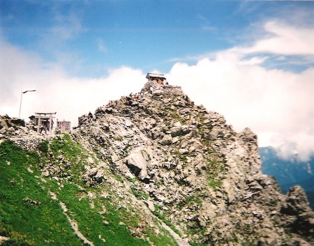
The hike: From Kitazawa-toge, you’ve got two options, but I’ll describe the more popular route that starts directly across from the Chouei-sou hut (長衛荘). The trail enters the forest and starts climbing almost immediately. You’ll pass by trail markers set up to divide the mountain into 10 stages (I’m not sure why the number 10 was chosen, but it’s consistent no matter what peak you climb in this country). It should take about 2 hours or so to reach the 5th stage (五合目), where you’ll find a trail junction. Both paths lead to the top, so consider doing a loop hike to minimize the environmental damage. I recommend taking the left fork towards Little Senjo-ga-take (小仙丈ヶ岳). You’ll break above the tree line pretty quickly after leaving the junction, so pray that the wind isn’t howling or that it’s not hailing. I had rainy weather but miraculously it wasn’t foggy at all, so visibility was phenomenal. I could even see Mt. Fuji! Anyway, when you reach the top of Little Senjo, you’ll see the huge col below the summit come into view. The ridge line is pretty rocky, and the path pretty much stays right on top of it, so follow the paint marks and you’ll be ok. It should take an hour or so to reach the top of Mt. Senjo, where you’ll have a birds-eye view of a fairly significant number of alpine peaks. Take a break and enjoy the vista! If you’ve got several days and would like an alternative trek bypassing Kita-dake, then you can take this ridge line all the way to Mt. Shiomi. Just take a left at the summit via Big Senjo-ga-take (大仙丈ヶ岳). Otherwise, continue towards the right and drop down to the Senjo hut (仙丈小屋). There’s a water source here and you can stay in the hut if you’d like to break the hike into 2 days (and try to catch the sunrise/sunset). Otherwise, keep going on the same path for about an hour until reaching Uma-no-se Bunki (馬ノ背分岐), which translates at “the horse’s back junction”. Take a right and soon you’ll reach the Uma-no-se hut. This is also a good place to stay, and if you continue past another trail junction you’ll find yet another hut. This one’s called Senjo-yabusawa (仙丈薮沢小屋) and it’s only open between mid July and mid August. There are no meals served here, but they have futon you can use. Just past this hut you may find a lingering snow field or two. They seem to stay around this part of the mountain even in the warm summer air. In around 20 minutes or so you’ll reach the trail junction at the 5th stage (where you started the climb above the tree line towards Little Senjo). Take a left and head back down to Kitazawa-toge. The entire hike should take anywhere from 5 to 8 hours depending on the weather and your speed.

When to go: As with Kai-koma, this hike can be done anytime the road to Kitazawa-toge is open. I’m not sure of the exact dates, but probably from Golden Week to early November. If you can make it to Kitazawa-toge, you can try a winter ascent just like these people did on New Year’s Eve!

Access: From Kofu station (甲府駅), take a bus bound for Hirogawara (広河原). From there, change to a bus bound for Kitazawa-toge (北沢峠) and get off at the last stop. Click here for the bus schedule (in Japanese).

Live web cam: Click here

Level of difficulty: 4 out of 5 (elevation change 1003m).

Mt. Asahi (旭岳)

June 16, 2008

Mt. Asahi is an active volcano and unofficial symbol of Daisetsuzan National Park. The stunning scenery and easy access make it popular with tourists throughout the year.

The hike: From the parking lot look for the trailhead on the right side of the road, easily recognizable with its huge yellow “Beware of Bears” sign. Most people use the gondola, which will probably make you the only one on the trail. Despite its lack of use, the trail is pretty well marked, with lots of wooden planks to keep hikers from trampling the vegetation. Be on the lookout for bears, and sing your favorite childhood songs if you’ve forgotten your bear bell. The path follows a stream most of the way before cutting toward the left for a somewhat strenuous climb to the top of the gondola. It should take about 90 minutes to reach the gondola trail junction, where you’ll meet the huge crowds of people who took the lazy way up. Turn right once you hit the junction, and you’ll find a stone emergency hut in about 20 minutes. This is here in case the volcano decides to burp while you’re climbing, and from the looks of the steam vents, the hut’s probably been used before. Continue climbing on the spine of the volcano. The maps say to allow 2-1/2 hours to reach the peak, but you can do it in half that time, as it’s only a 600m vertical ascent. The views from the summit on a clear day are fantastic, and you’ll see most of Daisetsuzan National Park rising up all around you. You can either head back down the way you came , or continue for an interesting loop hike. Descend down the other side of the mountain until you reach a small campsite. The descent is really steep, with a huge snow bank remaining most of the year. Continue up and over Mamiya-dake (間宮岳), turning left at the next junction to reach Naka-dake hot spring (中岳温泉), one of Japan’s hidden hot springs. It’s actually quite difficult to find hidden among all the boulders. Continue climbing past the hot spring to Susoai-daira (裾合平), where you’ll find a trail junction. Turn left to head back to the gondola, via the beautiful Fuufu lake (夫婦池). The entire loop should take between 6 and 8 hours, so plan accordingly.

When to go: The gondola runs all year round, so this hike can be done in the winter with an ice axe and crampons. If you don’t want to fork over the money for the gondola, then you should aim to go between Golden Week and mid September, when most of the snow is gone. The Youth Hostel near the trailhead is easily the best hostel in all of Japan, with a 24-hour outdoor bath and Canadian style log cabin. Click here for the website.

Access: From Sapporo station (札幌駅), take a JR Limited Express train bound for Asahikawa (旭川) and get off there. From the station, take a bus bound for Asahi-dake Onsen (旭岳温泉) and get off at the last stop. The bus runs throughout the year, but frequency varies based on the season. Click here to access the schedule.

Live web cam: Click here

Level of difficulty: 3 out of 5 (elevation change 1110m).

Mt. Tateyama (立山)

June 14, 2008

This blog post was written back in 2008. For the latest information about this hike (including color photos and maps), please consider purchasing my guidebook to the Japan Alps. 

Mt. Tateyama is the highest peak in Toyama Prefecture, and one of the 3 sacred mountains of Japan (after Mt. Fuji and Hakusan). Its easy access via the Tateyama-Kurobe Alpine Route ensures a healthy swath of tourists for most of the year.

The hike: From the bus terminal at Murodo, follow the paved path and signposts (and crowds) to Ichi-no-koshi Hut (一ノ越山荘), which sits on a saddle between the summit of Tateyama and Mt. Ryuou (龍王岳). It’s only a 200m vertical climb to the saddle, and it should take an hour or so. From here, turn left and start the real climb to the summit. The path is well-marked and there are lots of rocks to scramble over. It should take an hour or so to reach the rest house just below the summit of Oyama (雄山). There’s a spur trail leading to the shrine on the summit, but you’ve got to pay 500 yen to enter. After offering some coinage to the mountain deities, continue on the trail to the left of the shrine torii, following the rocky ridge line. You’ll reach the high point, Onanji (大汝山), in about 20 minutes. The views over the cliff edges down to Kurobe lake are unbelievable. If the weather is good then you’ll have a clear view over to Mt. Tsurugi, as well as the peaks of Hakuba across the valley. Either retrace your steps back to Murodo, or continue on the same trail, turning left at the next junction for an alternative loop trail back to the bus terminal via Raicho-daira (雷鳥平). Don’t forget to have a soak at Mikuri-ga-ike Hot Spring (みくりが池温泉). Click here for the website in Japanese.

When to go: This hike can be done from mid April to late November, when the Tateyama-Kurobe Alpine Route is open. Expect lots of snow if hiking before April and after mid-October. Click here to see the beautiful scenery during Golden Week. A winter hike is also possible if you’re prepared for meters of snow and a long, tough climb.

Access: From Dentetsu Toyama station (電鉄富山駅) take a local train bound for Tateyama (立山) and get off at the last stop. From there, change to the Tateyama-Kurobe Alpine Route, taking a cable car and then bus to Murodo (室堂). Click here for English information, including a detailed timetable.

Live web cam: Click here

Level of difficulty: 2 out of 5 (elevation change 615m).

Mt. Ishizuchi (石鎚山)

June 12, 2008

Mt. Ishizuchi is not only the highest peak in western Japan, but is also one of the 7 sacred peaks of Japan. Expect to run into a few Shingon pilgrims dressed in white, as well as the weekend crowds in autumn.

The hike: From the bus stop, hike along the road for a few minutes, and you’ll see some decrepit-looking buildings on your right. The trailhead is behind these buildings. It’s a little confusing at first because it feels like you’re hiking in someone’s yard. Click here to get an idea of what to look for. You’ll enter a dense cedar forest and soon come to your first junction. You can take either trail, but the one on the right is much steeper but shorter, with a lot of switchbacks. The trail to the left is more scenic, but crosses a mountain stream several times, so don’t take this trail if it’s been raining and the water levels are high. This trail is a more direct path to the summit. I’ll describe the other trail, however, because it’s the one I took. Head to the right and start climbing up the spur of the mountain, away from the water. It’ll take about 2 hours of pretty tough ascending before you reach the top of the gondola. You’ll find a junction and will see your first signs of development. Head left at this junction (turning right will take you to the top of the gondola), and you’ll arrive at the main shrine shortly. This is a popular place of worship for Shingon buddhists, and if you’ve come on the weekend you’ll find lots of people. The souvenir shops sell conch shells and other pilgrim accessories. I was lucky to witness a group of about 75 pilgrims, all blowing their shells in unison inside the main shrine! After saying a few prayers, turn left and cross through the large wooden gate. This is where the true climb begins, and the path is very well marked. The first 20 minutes is actually down, and you’ll reach a 4-way junction called Hacho (八丁). Ignore the trails off to the left, as they descend towards where you started the hike, and head straight. You should reach a place called Zenjamori (前社森) in about an hour or so, and Yoake-toge (夜明峠) a short time after that. Here you’ll find yet another junction (Ishizuchi has no shortage of hiking options), but ignore the trail to the left and head straight. Keep climbing up and up, and you’ll reach ajunction for the trail to Tsuchi-goya on your left. Ignore this and pass through the shrine gate and climb the concrete stairs to the toilets. The toilets are clean and require a 100 yen donation to use. Just above this toilet complex, the trail fork to the right. There’s a trail heading straight on that leads to a series of long chains that pilgrims and adventure seekers use to scale the mountain. The chains can get quite crowded and if you suffer from a fear of heights you’re much better off sticking to the main trail on your right. There are 3 sets of chains in all, and I would not advise using them to descend or in wet conditions. Continue climbing up the steel staircases built into the mountain and in about 20 minutes you’ll reach the summit of Misen (弥山), where you’ll find a large hut and small weather beaten shrine. The view of Tengu-dake (天狗岳), the high point, is impressive. It should take about 15 minutes of climbing on a precarious knife edge ridge to reach the summit, where you’ll have outstanding panoramic views of most of Shikoku. If the weather is bad then I don’t suggest trudging along to Tengu, as the views will be the same as from Misen. Anyway, retrace your steps back to the shrine gate at the saddle below the peak, where a choice will have to be made. If you turn right then you can descend down to the Tsuchigoya (土小屋) bus stop in about 90 minutes. Alternatively, you can descend all the way back you came by turning right at Yoake-toge and following the signs to Nishinokawa.

When to go: This hike can be done year round if you’ve got the proper equipment for winter climbing. Otherwise, aim to go between April and late November. The gondola runs all year round because there’s a small ski resort on the mountain. Click here to see someone who climbed in January.

Access: From Matsuyama (松山) station in Ehime Prefecture, take the JR Limited Express ‘Shiokaze’ train and get off at Iyosaijo (伊予西条) station. The train takes about an hour and costs around 3000 yen. A local train takes twice the time but is half the price. From Saiyo, take a bus bound for Nishinokawa (西之川) and get off at the last stop. There are only 4 buses a day, so plan accordingly. Click here for the bus schedule. If you want to take the expensive gondola, then get off one stop earlier at Ishizuchi Ropeway Mae (石鎚ロープウエイ前)

Live Web Cam: Click here

Level of difficulty: 4 out of 5 (elevation change ~1500m).

Hakusan (白山)

June 3, 2008

Last updated: Feb. 2, 2025

Due to the risk of volcanic eruptions, it is now mandatory to submit a tozantodoke form if you’re climbing Hakusan. Violators may be subject to a 50,000 yen fine, so please fill out the form at the trailhead before climbing. Click here for more information. 

Hakusan, appropriately translated as ‘White Peak’, is an impressive edifice towering over Ishikawa Prefecture. The summit features unique volcanic strata, as well as wonderful crater lakes. The panoramic views of the Japan Alps aren’t half bad either.

The hike: From the bus stop, you’ve got 2 options. Either take the track to the right, called Sabou Shindou (砂防新道) or the trail to your left, called Kankou Shindou (観光新道). One or the other may be closed when you go, so take whichever is open. I’ll describe the hike using Kankou Shindou. Fill up your water bottles at the resthouse, because it’s a long, long way to the top. The first 90 minutes of the trail is pretty straight forward, and you’ll cross over a forest road several times. You’ll reach a junction called Bettouzaka-bunki (別当坂分岐). Ignore the trail coming in from the left, and continue towards the right. The trail keeps climbing up and up, on a seemingly endless array of switchbacks. The views down into the valley will also pretty impressive. You’ll reach an emergency hut in about 2-1/2 hours, and the trail will start to become a little easier after this point. In another 40 minutes or so, you’ll reach another trail junction, where the Sabou trail comes in from the right. From here to the summit, it’s just one trail, and you’ve only got 100 vertical meters or so to Murodo hut, which should take about a half hour to reach. The hut is open from May 1st to October 15th, but only serves meals from July to October. Consider staying here if you’re up for the weekend, as the sunsets are spectacular. There’s no campground here, but if you continue an hour south you can camp at Nanryu hut. Anyway, it should take about 40 minutes from Murodo to the top of Hakusan. If the weather is good then you’ll have outstanding panoramic views. You can do a loop hike from the top back to Murodo, passing by several picturesque volcanic lakes. The loop takes about an hour to complete. From the summit, you can either head south to complete a traverse of the Hakusan range (via Bessan), or return the way you came. I did the full traverse, but don’t recommend it as you end up in the middle of nowhere and have to walk on a forest road for quite a while to get back to civilization. Of course, I had lousy weather the entire trip, so my feelings would most likely be different if I had more co-operative weather.

When to go: This hike can be done during July, August, and September, when the buses to Bettoudeai are running. If you’ve got your own transport, then you can definitely go much earlier than this. The road to the trailhead doesn’t open until the end of May, but that doesn’t stop hoards of climbers from hiking along the closed road to the trailhead, and continuing from there. Click here to see the conditions during Golden Week!

Access: From Kanazawa (金沢) station, turn right out of the ticket gates and go out the East gate. You’ll see a bus rotary on your left. Walk out to bus stop #1 and take a bus bound for Bettoudeai (別当出合). There seem to be fewer and fewer buses every year. For 2015, there are buses on June 30, July 1, July 4 & 5, August 13, 14, 15 & 16, and on weekends only between August 22 and October 12. Click here for the bus schedule.

Digital Map (Avenza App): Click here

Level of difficulty: 4 out of 5 (elevation change 1452m).

Mt. Kirishima (霧島山)

June 2, 2008

Kirishima Nat’l Park is a glorious collection of picturesque volcanic peaks, majestic crater lakes, and soothing hot spring baths. The area around Ebino Kogen (えびの高原) is filled with lots of hiking options, including the ascent of Mt. Karakuni, the highest peak in the park.

kara2

Special note: The trail up through Iodake is now closed due to volcanic activity. The only trail open to the summit of Mt. Karakuni is via Onami crater (near Tsutsujigaoka bus stop).

The hike: When you get off the bus stop, you might want to take a little time to familiarize yourself with the layout of the facilities. There’s a useful billboard map just outside of the Eco Museum Center. Across the street from the museum, you’ll see a souvenir shop, as well as a foot bath in the new building next to the museum. There’s a great cafe inside this building that has amazing soft serve ice cream and good coffee. Just to the left of the museum, there is a trail that is marked as the Ikemeguri Nature Trail (Volcanic Lakes). This is a two-hour loop hike that leads past a couple of lakes before meeting up with the main road just opposite the trailhead to Mt. Karakuni (韓国岳). If you’ve got time, then it’s a nice stroll through a beautiful forest. Otherwise, just follow the signs marked for Mt. Karakuni. You could also walk along the road if you like, but the asphalt path that parallels the road is much nicer. After about twenty minutes you’ll finally reach the mountain path, which climbs some steps and juts around Mt. Ioyama (硫黄山), an active steam vent with some large sulfur deposits. There are a couple of trails that go through Mt. Ioyama, but ignore then and turn right, following the crowds if you’ve come on the weekends. You’ll soon come across a rusty metal box that hikers can use to register their climbing intentions, as well as a couple of benches you can relax on and enjoy the scenery. The trail cuts left here and after a short climb, enters a beautiful forest with lots of moss and perhaps a few wildflowers depending on the season. You’ll soon reach a signpost for the 1st station (一合目). The mountain is divided into 10 stages, so you can use these markers to help you establish a pace and decide when to take breaks. From here it’s only 1.7km to the summit, and it’s a relatively easy climb with lots of steps built to aid in the ascent. It’s a popular mountain with school trip and families, so don’t be surprised to see a fair number of kids marching up the volcano. The views start to open up as you climb higher, and the best place for your first break is the 5th station (五合目), which is a wide area with splendid views into the valley below. From here, the angle eases up a bit as you traverse towards the crater rim (at the 8th station), which can be reached in about 15 minutes. If the weather is good then you’ll can take one of the many side trails to the left up to the rim, which is roped off to prevent people from falling inside. Just before reaching the high point, you’ll see a trail shooting off on the right marked for Mt. Oonamiike (大浪池). Ignore this trail for the time being and turn left for the short climb to the summit, which is marked with a signpost and a village of large volcanic rocks. If the weather is good then you’ll have outstanding panoramic views of most of the mountains of southern Kyushu. Sakurajima is due south, and just to the left of that peak you can see Mt. Kaimon if you’re lucky. To the east, you’ll see the active lava dome of Mt. Shinmoe (currently closed to hikers), with Mt. Takachiho rising up behind. Unfortunately, Mt. Karakuni is a magnet for cloud, and clear weather is a rarity indeed. After you’ve had sufficient rest, drop down to the junction and take the trail for Mt. Oonamiike, which in clear weather you can see directly below you. It’s an incredible caldera lake formed during an ancient eruption. The path drops off the peak abruptly, through red scree reminiscent of the slopes of Mt. Fuji. You’ll soon reach an area of wooden steps that have been added to make the climb easier. The rest of the trail down to the lake is on these steps 80% of the time, so be careful in wet weather when these wooden stairs become as slick as ice. It should take about an hour or so to reach the base of the caldera lake, where you’ll reach a junction. There’s a small emergency hut on your left, as well as a trail that goes straight ahead. Take this trail if you want to do a loop around the caldera rim, which should take about an hour or so. Only do this when the weather is clear. Otherwise you won’t be able to see the caldera lake at all. A shorter option is to ignore this trail and turn right, where you’ll soon see a wooden platform that makes a great place to take a break. Continue on the trail and you’ll soon see a junction on your left marked for Lake Onami trailhead (大浪池登山口). This is where the loop trail comes down, so if you didn’t do the loop but still want a glimpse of the caldera lake then turn left here and climb up the steep trail for about 10 minutes until you see a spur trail on your left that leads to a lookout. After viewing the lake, retrace your steps back to the main trail and turn left, following the signs as the trail following the meandering contours of the mountain before finally dropping back down towards Ebino Kogen. The steep path will eventually level out and take you through an amazing forest of moss covered rocks and old trees. The trail ends at a paved road, so turn right and walk about 50 meters and you’ll see Tsutsujigaoka (つつじヶ丘) bus stop, which you can take to get back to Maru-o. You could also try your luck hitching from here as well. If you’ve got time before the last bus then you could have a hot spring bath at Ebino Kogen Sou (えびの高原荘), which is a short walk from the Eco Museum Center. To get there you can cut through the large grass-covered park directly across the street from the bus stop. Turn right on the trail just behind the toilets.

Special Note: If you’re attempting to do the entire Kirishima traverse (from Karakuni to Takachiho) please note that the trail up and over the summit of Mt. Shinmoe is currently closed due to volcanic activity.

When to go: This hike can be done year round, but expect some snow during the winter, when light crampons will come in handy. Click here to see the winter scenery. Avoid the peak in the middle of the summer, when the heat can be unbearable.

Access: There are numerous ways to get to Ebino Kogen, but perhaps the easiest is to take a train from Kagoshima station on the JR Nippo Line (JR日報線) and get off at Kirishima-Jingu (霧島神宮) station. From there, you can take a bus bound for Kirishima Iwawaki Hotel (霧島いわわきホテル) and get off at Maru-o (丸尾) bus stop, where you need to change to a bus bound for Takachigo Kawahara (高千穂河原), which will stop at Ebino Kogen. There are only 3 buses a day from Maru-o, so make sure you plan accordingly. The local train takes about 50 minutes from Kagoshima, and the Limited Express only saves you 3 minutes! Click here to download the bus schedule. Click on the second link that reads 各路線バス時刻表. If you want to hitchhike, the closest station seems to be Kirishima Onsen (霧島温泉), so get off there and walk to the main road.

Map: Click here

Live web cam: Click here

Level of difficulty: 2.5 out of 5 (elevation change 520m).]

This slideshow requires JavaScript.

Gassan (月山)

May 30, 2008

Last updated: Feb 17, 2025

Gassan is highest peak in the Dewa Sanzan trio of religious mountains, nestled snugly between Mt. Chokai and Mt. Asahi in Yamagata Prefecture. Known for white clad pilgrims and summer skiing, the peak offers alpine vegetation and scenery without climbing to air thinning altitudes.

The hike: From the parking lot, follow the signs (and crowds) towards Gassan shrine (月山神社). The path is well trodden and easy to follow. You’ll reach a mountain hut in about 90 minutes or so, at the base of Mt. Omowashi. The trail starts to get a little steeper from this point, but overall it’s a relatively easy and enjoyable ascent. It should take another hour or so to reach the summit area, which is pretty overdeveloped. There’s a huge shrine on the summit, which you’ll have to pay to enter. The true high point, however, is on a group of unmarked rocks directly behind the summit, and it won’t cost you a thing to sidestep the shrine and enjoy your lunch away from the crowds. There’s a big hut a short descent from the shrine, appropriately named ‘Summit hut’ (山上小屋). The hut is only open from late June to late September, and doesn’t have any drinking water for non-staying guests. Continue past the hut, and turn right at the next two junctions, where you’ll drop to a huge saddle. This is where you’ll see summer skiers. At the saddle, you’ll find a two-way junction. You can either turn left to reach the top of the chairlift, or continue straight towards Mt. Yudono (湯殿山). I recommend heading straight, unless the weather has turned foul or it’s getting late. You’ll reach a junction in about 20 minutes, but ignore it and stay on the ridge line. Another half hour or so along the trail and you’ll be standing at the base of Mt. Yudono. There’s a water source and a free emergency hut here, as well as a 2-way junction. Turn right to drop to Yudono shrine, or take a right to descend to Shizu (志津) campground. Unfortunately, there’s no trail up to the summit of Mt. Yudono, so you’ll have to be content with staring at it from the hut. The drop to Yudono shrine is pretty big, but you’ll be rewarded with a foot bath on the shrine grounds. If you’re headed in the direction of Mt. Asahi, however, I recommend turning left and descending to Shizu. It should take about 90 minutes of enjoyable hiking to reach a nature museum and the campground. Be extremely careful crossing the numerous wooden bridges if it’s wet. I went sliding off one into a creek about a meter below the trail! The campground surrounds a scenic lake, and each site costs 500 yen (register at the hut). If you continue walking down route 112 for about 1/2 an hour, you’ll find Shizu hot spring. Another half hour or so beyond that, and you’ll be sitting in a huge auto campground. Whatever you do, don’t descend this far, because they’ll try to charge you 3500 yen for a place to pitch your tent! Luckily the staff gave me a ride all the way back up the road to the cheaper and more scenic Shizu campground. There are buses back to civilization from the campground, but unfortunately I couldn’t find any on-line information. Hitching is also a definite possibility.

When to go: The buses from the Mt. Haguro side only run from July 1st to August 24th, but you can definitely go earlier than this if you’ve got your own transport. The peak gets meters upon meters of snow in the winter, and stays around most of the summer. Click here to see the conditions during Golden Week.

Access: From Niigata (新潟) station, take the JR limited express ‘Inaho’ to Tsuruoka (鶴岡) station. From there, take a bus bound for Gassan-hachigome (月山八合目) and get off at the last stop. The bus makes a 8-minute ‘pit stop’ at the top of Mt. Haguro (羽黒山頂), allowing enough time to offer a quick prayer to the mountain deities. Double check with the driver to see how long the break is.  Click here for the bus schedule.

Digital Map in English (Avenza App): Click here

Level of difficulty: 2 out of 5 (elevation change 824m).

Mt. Myoko (妙高山)

May 28, 2008

Mt. Myoko is a steep, rocky, volcanic peak located just across the Nagano border in Niigata Prefecture.  Famed for winter skiing and hot springs, the area is certainly worth exploring.

The hike: From the bus stop, head up the paved road past the hotels. The road will turn to gravel and you’ll see a signpost point the way to Mt. Myoko (妙高山). Additionally, you’ll pass by a really famous mixed, outdoor bath called Ougon-no-yu (黄金の湯), with milky white water. It looks like a great place to take a bath, so keep it in mind if you end your hike here. Anyway, the path initially follows a forest road through the Seki ski fields before reaching the trailhead proper. Follow the path for about an hour before arriving at 2 huge waterfalls. There is a section with a few chains and you’ll climb up and to the left of the falls. A few minutes past the falls you’ll see a path come in on your right. This will lead back to Tsubame hot spring, but there’s no need to turn back so soon. Cross the river, being very careful during periods of heavy rain if the river is swollen. Follow the paint marks and the path for about an hour to reach Tengudaira (天狗平), where you’ll find a junction. If you turn left then you’ll reach a forest road at the top of Ike-no-daira ski resort in about 20 minutes (an alternate way off the mountain). Ignore this path and turn right. You’ll pass by a small lake and will eventually reach the rocky summit area. There are a few chains bolted into the rocks, so use them to help you climb higher and higher. You should be sitting on the summit about 2 hours after leaving Tengudaira. On a clear day the views are outstanding. From here, you’ve got several options. You can continue traversing down the other side of Mt. Myoko and over to Mt. Hiuchi. If you’re only up for the day, then descend back to Tengudaira and either turn right to get to Ike-no-daira and Akakura Onsen Ski Resorts, or turn left and head all the way back to Tsubame. No matter which way you go, you’ll have plenty of options for a nice hot bath.

When to go: This hike can be done from mid July to late October. It’s also possible to go earlier in the season but be prepared for a lot of snow.  The steep summit area is heavily prone to avalanches, so a winter ascent is not recommended.

Access: From Nagano station, take a local train on the JR Shinetsu line (JR信越線) and get off at Sekiyama (関山) station. The train takes about 40 minutes. From there, take a bus bound for Tsubame Hot Spring (燕温泉). Click here for the bus schedule. Depending on your plans, it might be more time efficient to take a taxi to the start of the hike (which should cost around 2000 yen or so).

Live web cam: Click here

Level of difficulty: 3 out of 5 (elevation change ~1200m).

Mt. Goryu(五竜岳)

May 24, 2008

Mt. Goryu is a peak many have stared at from Goryu/Hakuba 47 ski resorts, but few have thought about climbing out of season. A venture beyond the slopes, however, will reveal a magical alpine world filled with flowers, alpine lakes, rocky peaks, and stunning views.

The hike: From Kamishiro station, walk out the front door and turn right on route 148 in front of you. Walk about 100m and turn right at the next stop light. This street will take you all the way to Escal Plaza, the start of the hike. You’ll pass by Hakuba Alps guesthouse, as well as countless other pensions and hotels. It should take about 20 minutes of road walking before reaching the ski resort. There is a gondola that will whisk you up to the top of the ski resort in only 7 minutes. The problem with the gondola is the start time. The first one isn’t until 8:15am on most days (and it doesn’t even run between May 15th and June 28th!). Click here for info. Anyway, it’s darn near impossible to do this as a day trip unless you camp in the ski resort. I recommend camping at the bottom of the Dai 2 & 4 (アルプス第2) ski lifts. Set up your tent on the wooden platform under the lifts and enjoy the awesome night view of Hakuba village. You can follow the forest road that cuts through the ski resort. The next day, just continue following the lifts up to the high point of the resort. From there, follow the signs towards Mt. Kotoomi (小遠見山), which should take about an hour to reach. The panoramic views of Mt. Kashimayari, Mt. Goryu, and Mt. Shirouma are fantastic. From here, the signpost says it’ll take 6 hours to reach the summit, but you can do it in less time if you’re fit. Follow the ridge line for several hours. If the weather is good then you can see exactly where you need to go. There’s a lot of up & down, and be careful of crevices if there’s any remaining snow. Just before you reach Mt. Nishitoomi (西遠見山), you’ll find a small lake with a beautiful reflection of Mt. Goryu. The path between NIshitoomi and Mt. Shiro (白岳) is steep, exposed, and covered in snow most of the year. During the month of May, you can easily bypass Mt. Shiro and go directly to the hut by traversing through the deep snow, but be careful of snow slides. Once you reach the top of Mt. Shiro, you’ll meet up with the main Shirouma-Oomachi trekking route. Turn left and descend steeply to Goryu hut (五竜山荘). You can buy water here and stay the night if you’d like. Take a break, because the biggest climb awaits you. The map says to allow one hour to reach the summit, but if there’s remaining snow it can take twice the time. You’ll basically be rock climbing most of the way, but it’s not too bad compared to some other peaks out there. The views from the summit are incredible, and you’ll see all the way out to Mt. Fuji on a clear day. You can continue trekking over to Mt. Kashimayari, or head back to the hut. If you’ve got a few days, then you can head the other direction over to Mt. Karamatsu towards Mt. Shirouma. If you’re a sucker for punishment like I was, then you can head back down the mountain the same day. I descended from the hut to the ski resort in less than 2 hours, thanks to the massive amounts of snow remaining.

When to go: This hike can be done from Golden Week to mid-October, when Goryu hut is open (五竜山荘). There will be a lot of snow if you go before July, so bring crampons and an ice axe and do not attempt in bad weather. A winter ascent is also possible, but be careful of avalanches in the col below Mt. Shiro (白岳)

Access: From Matsumoto (松本) station, take a local train bound for Shinano-omachi (信濃大町). From there, change to another local train bound for Minami-otari (南小谷). The trains are not very frequent, so take care when planning. Another option would be to take a Limited Express train to Hakuba (白馬), and either backtrack on a local train or take a taxi to the ski resort.

Live web cam: Click here

Level of difficulty: 5 out of 5 (elevation change ~2100m).

Mt. Utsugi (空木岳)

May 20, 2008

This blog post was written back in 2008. For the latest information about this hike (including color photos and maps), please consider purchasing my guidebook to the Japan Alps. 

Mt. Utsugi is the highest peak in the southern half of the Central Alps. The exposed crags offer outstanding panoramic views of both the Kita and Minami Alps.

The hike: From the top of the gondola, take the trail to the left towards Gokuraku-daira (極楽平). It should take about 20 minutes to reach the ridge line, where you’ll be all day. Turn left once you reach this point, and make your way to the top of Mt. Hinokio (檜尾岳). The path is well-worn and easy to follow and you should be sitting on the rocky summit in about 2 hours. If the weather is clear then you should see the top of Mt. Fuji peeking out over the Minami Alps, as well as a stellar view of Ondake. Your next target is Mt. Kumasawa (熊沢岳), reachable in about an hour. Another hour after that, and you’ll be on top of Mt. Higashi-kawa (東川岳), which has a great view of Mt. Utsugi right in front of you. Unfortunately you’ve got a big drop and climb between here and there. Drop down to the saddle, where you’ll find Kisodono hut (木曽殿山荘), which is a pretty nice place to stay. Unfortunately there’s no room to camp here, and the water source is a 15-minute walk down a spur trail. The hut is only open from July 1st to October 10th, so if you’re going outside of these dates it’s better to push on and stay at the emergency hut on the other side of the summit. Click here for the hut website. From the hut, it’s a 90 minute climb with a 450m elevation gain to the top. The hard work is worth it when the weather is cooperative. Otherwise, it’ll be another rocky peak in a blanket of cloud. From the top you’ve got several options. You can either retrace your steps back to Kisodono hut, and take the trail to the left for a 7 hour descent to Kuramoto (倉本) station, on the JR Chuo line that runs between Nagano and Nagoya. Another option would be to continue on the ridge line towards Minami Koma-ga-take (南駒ヶ岳) and then descent about 3-1/2 hours to a forest road in the middle of nowhere. The final (and probably most feasible) option would be to turn left once you hit the top of Mt. Utsugi and descend to the Mt. Utsugi emergency hut (空木避難小屋). From the hut, it’s a grueling 4 hour descent, where you lose close to 2000 vertical meters of altitude! You could also do this hike in reverse, but you’re faced with a daunting climb if you do. Eventually the trail will spit you out in Komagane Kogen (駒ヶ根高原), where you can take a bus back to Komagane station.

When to go: This hike can be done from early June to mid October without too much trouble. The gondola is operational year-round, so you could attempt this in the winter if you’ve got the proper equipment and training, but be warned that the ridge line is very rugged. Click here to see some brave climbers during Golden Week!

Access: From Okaya station (岡谷駅) in Nagano Pref. take the JR Iida line (JR飯田線) and get off at Komagane Station (駒ヶ根駅). The local train takes about an hour. From there, take a bus bound for Shirabi-daira (しらび平) and get off at the last stop. If you don’t want to take the gondola, then you can bypass this area by taking a trail from Hinokiobashi (檜尾橋) bus stop. From there, it’s a grueling 6-hour climb to the ridge line just below the top of Mt. Hinokio (檜尾岳). There’s a free emergency hut you can stay in just below the summit. Click here for the bus schedule.

Level of difficulty: 4 out of 5 if using the Gondola (elevation change ~200m).