This blog post was written back in 2009. For the latest information about this hike (including color photos and maps), please consider purchasing my guidebook to the Japan Alps.
Ainodake is the center peak of the Shirane-sanzan trio of summits in the Minami Alps, and is best climbed in combination with adjacent Kitadake, Japan’s 2nd tallest mountain.

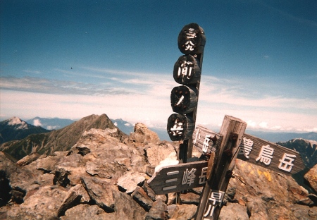
The hike: Follow the description outlined in the Kitadake hike, but instead of turning left at the first junction after reaching the top of Kitadake, continue descending on the rocky ridgeline to Kitadake-sansou (北岳山荘). The hut, located at 2,900m above sea level, is open from the middle of June to early November, and has room for 150 people. There’s also a large, exposed campground just behind the hut. Click here for the website. From the hut, it’s another 90 minutes or so of traversing above 3000m to the summit of Ainodake, the 4th highest peak in Japan. The views of Mt. Fuji are just as stunning as they were from Kitadake, as long as the weather is good. If not, then you’re in “no-man’s land” as far as sheltered comfort goes. You’ve got 3 options from the summit. You can either take the right fork and continue along the ridge to the top of Mitsumine-dake (三峰岳) before dropping to the hut and campground at Kuma-no-daira (熊の平), or take the left fork to the summit of Mt. Noutori (農鳥岳), the 3rd and final peak of Shirane-sanzan. Allow around an hour or so to reach Noutori hut (農鳥小屋), which offers similar accomodation to the other huts in the vicinity. Click here for the website. The final option is to retrace your steps back to Kitadake-sansou, following the trail on the right to the Happonba col (八本歯ノコル). It’s an extremely narrow and tight squeeze on a trail reinforced with wooden stairs and ladders. Click here to get an idea of what you’re in store for. At the top of the col, hang a left for the roughly 3 hour ascent back to Hirogawara (and watch out for lingering snowfields).
When to go: This hike can be done from early June to early November. The road to Hirogawara is closed in the winter, so it’ll be pretty difficult to get here unless you snowshoe or ski a long way to the trailhead! You could go a little earlier if you’ve got an ice axe and crampons.
Access: From Kofu station (甲府駅), take a bus bound for Hirogawara (広河原). Click here for the bus schedule in Japanese.
Level of difficulty: 4 out of 5 (elevation change 1670m)

