Mt. Ryokami is an ancient, rocky peak sitting on the border of Gunma and Saitama Prefectures. The top offers wonderful panoramic views of the surrounding mountainous landscape and is a part of Chichibu-Tama-Kai National Park.
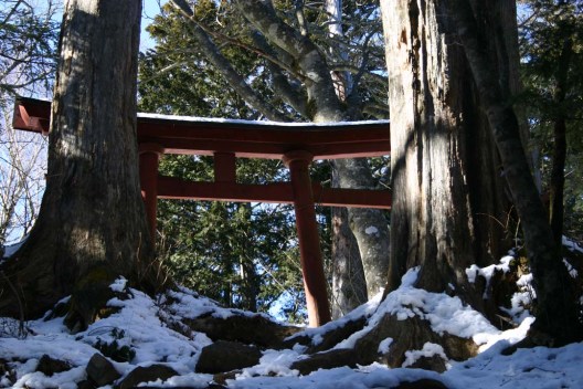
The hike: From the bus stop, climb the stairs across the street to Ryokami Hut (両神山荘). This hut features a real kotatsu (the heater is a fire pit in the floor) and is a great place to rest after the hike while waiting for the bus. The trail goes to the left of the hut and climbs steeply past vegetable fields and enters a dense forest. During the first half an hour or so keep your eyes peeled for Kamoshika (Japanese Mountain Serow), as there are a few in this area. I saw one on the way back to the bus stop after completing the hike. Soon you’ll come to a trail junction. Both trails meet up after a few hours, but the one on your right isn’t well used, so stay on the main, well-trodden path. From this junction, it’s a gradual climb for the next 90 minutes or so in a shaded valley following a stream. The trail starts to get steeper and steeper, but you’ll have a nice big hut (清滝小屋) staring you in the face in next to no time. This hut has water and is a lovely place to stay, costing 5000 for 2 meals, or 3000 yen for a place to sleep only. (the hut is only open from April to November) Alternatively, you can camp nearby. Take a break here, as things are about to get rocky. The trail continues past the hut and then gets really steep. Some of the rock formations have chains embedded for ease of climbing. In about an hour of sweating it out you’ll reach a shrine and the trail will start to get much easier. From here to the top it’s just a matter of traversing a few “false summits”. There’s quite a bit of up and down, but a piece of cake compared to what you’ve been through. Eventually you’ll reach the true summit, marked by a signpost and a huge rock formation. Enjoy the panoramic views, with Mt. Asama staring you in the eyes, the Minami Alps and Yatsu-ga-dake to the Northeast, and Mt. Fuji poking its shy head up above Mt. Kumotori. Take a well deserved lunch break and head back the way you came. If you’d like to turn this into a 2-day hike then consider staying at the hut along the way or at the hut at the bus stop.
When to go: This hike can be done year round, but bring crampons in the winter because it can get quite icy and the main trail sits in a shaded valley.
Access: From Ikebukuro station, take a train on the Seibu Line to Chichibu Station. From there, transfer to a bus bound for Hinata Ooya (日向大谷). You’ll more than likely have to change buses at Oganomachi Yakubamae (小鹿野役場前). The bus takes a little over an hour (about 15 minutes on the first bus, and then around 50 on the second). Click here for the bus schedule.
Map:
Level of difficulty: 3 out of 5 (elevation change: 1053m)


