Situated on the edge of a UNESCO World Heritage forest, Mt. Shirakami offers a glimpse into the ecosystem of yesteryear, with ancient beech trees, untamed wildlife, and jaw-dropping oceanic views.

The hike: If you’ve come by train, you’ve got an awful lot of walking just before reaching the trailhead, so make sure you start early unless staying in the emergency hut on the summit. Go out the exit of the unmanned station and walk to the main road (route 101). Turn right and walk along the road for about a half a kilometer until you see a road on your left. There’s a sign here pointing towards Shirakami-dake trailhead. The road skirts past an unmanned rest house on your right before passing by Shirakami-Sanso, an alternative place to stay if you’re short on daylight. Continue climbing past the hut on the forest road, and after about 30 minutes you’ll reach the parking lot and toilet block. There’s also an unmanned hut just adjacent to the toilets. If you’re just going up for the day, then it’s a good place to stash the gear. Take the path just to the left of this hut and soon you’ll reach a paved forest road. Turn left and stroll for about 10 minutes until reaching the real trailhead. From here, the path shoots into the forest, meandering a bit before starting the long climb towards the main ridge. There’s been a bit of cedar tree planting, but the farther you push, the more native the flora becomes. After all, you’re sitting on the edge of a World Heritage forest. Your first big landmark comes after 1.5km in the form of a trail junction. Here you’ll find a rather large signboard (案内図) declaring the path towards the right for experienced hikers only. I recommend staying towards the left here and returning from the summit via this “expert” route, which is known as the futamata course in Japanese (二股コース). From this junction, the trail becomes predominately steeper, with long switchbacks and wooden stairs in places. You’ll find signposts placed regularly throughout the entire route, which you can use as a judge for your timing and pace. It’ll take around an hour or so from the junction to the ridge, where you’ll see an unmarked trail towards your left. Apparently this leads to the summit of Mt. Mate (蟶山), but you can ignore this since you’ll be getting panoramic views soon enough. Turn right and start the up-and-down climbing on the main spine of the long mountain. It’s pretty steady going until you reach the signpost that reads “白神岳山頂へ1.5km”. As soon as you see this sign, take a long break and stuff your face with peanuts, as things are about to become pretty tough. It’s an uninterrupted 800 meter climb to the summit ridge. Take it one step and a time and don’t forget to look behind you for views of the Sea of Japan far far below. The alpine flowers in this section are stunning, and before you know it you’ll reach the junction drenched in sweat. Congratulate yourself, as the hard climb is pretty much over. You’ll see a trail branching off to the left towards Juniko (十二湖), but disregard this approach and turn right for the short 15-minute climb to the summit. The Juniko course is long and tough, but could be an alternative way of getting off the peak if you’re staying on the summit. The path is rarely used, so you’ll need to be extremely careful of black bear encounters, as a man was attacked there in 2010. From this junction to the peak it really is a pleasant stroll, with panoramic views towards Mt. Iwaki on your left. You’ll soon reach an emergency hut and toilet, which would make for a great place to stay if not for the lack of water. If you’re overnighting here, bring plenty of water from the valley below. Once on the top, take a well-deserved break and admire the stellar views. You’ve got 2 choices from the top. You can either retrace your steps all the way back on the trail you came up, or opt for the Futama course. I did the loop, and boy is it not for the faint of heart. To start, it’s a sheet drop off the side of the peak, with about 1km of continuous rope. Whoever built this trail must’ve been completely insane or just incredibly lazy not to bother with putting in switchbacks. Your knees will surely take a beating on this no-nonsense route. Bring gloves to prevent rope chafing on the impromptu rappel. Once the ropes end, it becomes a much more manageable descent until you reach the river below. You’ve got 2 river crossings, so proceed with caution if the river is swollen. Both are marked with tape, and once you get past those the path turns into a long traverse over several smaller ridges before arriving back at the junction you saw near the start of your climb. All in all it should take anywhere from 6 to 8 hours to complete the entire hike.
When to go: This hike can be done from June to October, when most of the snow is gone. A winter hike is pretty much impossible with the insane snow depth and huge avalanche risk. Bear sightings are a real possibility on this hike, as the area has the highest concentration of black bears on Honshu.
Access: From Hirosaki (弘前) station, take a train on the JR Gono Line and get off at Shirakamidaketozanguchi (白神岳登山口). You’ll need to change trains at either Fukaura or Higashi-Noshiro, depending on which train you take. A faster approach might be to take a Resort Shirakami express train and change to a local train at Juniko (十二湖) station, or perhaps try approaching from Akita city in the south. A better option might be to stay the night at either Moriyama Sou (森山荘) near Juniko station or at Shirakami Sansou near the trailhead.
Level of difficulty: 5 out of 5 (elevation change 1225m)
Distance: 19km (6 to 8 hours)
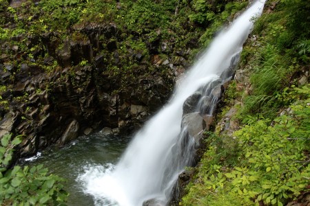
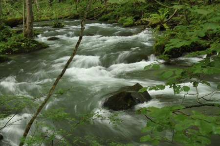
This slideshow requires JavaScript.